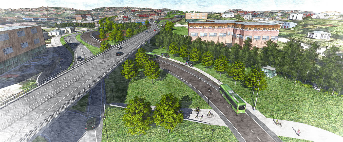
Preparation of a local authority subplan with impact assessment for eight kilometres of four- to six-lane motorway and a new parallel/main collector road.
Plans call for a separate bus lane and main cycle lane along the corridor. In association with the bus lane, a new bus terminal providing increased capacity is planned at Asker Station. The assignment also includes the northern part of the Røykenveien road and solutions for connecting the Slemmestadveien road.
This is primarily an environmental project which will lay the basis for an improved transport system, with the focus on public transport and cycling along the corridor and with urban development around the public transport hubs. It will reduce barrier effects, noise and local pollution.
Scope of work
Internal coordination meetings were held regularly with all technical disciplines.
Regular project meetings were held with the Norwegian Public Roads Administration and Asker local authority.
Involvement by and information to affected parties were secured through contact-group meetings.
Cross-disciplinary 3D design in the early phase.
Our services
- Road design
- Landscape plans, including cross-sections
- 3D structural engineering
- Soil surveys
- Noise and air quality assessments
- Cross-disciplinary 3D model, Infraworks and Lumion
- Impact assessment
- Local authority subplan with plan description
- Technical/economic plan
- Aimsun traffic model